ACEINNA Inc., which develops intertial-based guidance systems for autonomous vehicles and robots, today announced that Geosun Navigation Technology Co., which makes lidar-based navigation systems for drones and remotely operated vehicles, has chosed its inertial measurement units.
Andover, Mass.-based ACEINNA provides sensors for the automotive, industrial, telecommunications, datacenter and cloud infrastructure, consumer appliances, agricultural, and construction markets. The company said its micro-electromechanical, open-source positioning systems can provide centimeter-accurate navigation. ACEINNA has research and development facilities in San Jose, Calif.; Andover, Mass.; and Chicago, as well as manufacturing facilities in Wuxi, China.
Wuhan, China-based Geosun's intellectual property is dedicated to the application of GNSS (Global Navigation Satellite System), INS (inertial navigation systems), and GIS (geographic information system) expertise. The company said it focuses on satellite and integrated navigation positioning. It also develops, produces, and sells lidar scanners, POS systems, and PPK (post-processed kinematic) and RTK (real-time kinematic) equipment.
Geosun to use IMUs in lidar scanners
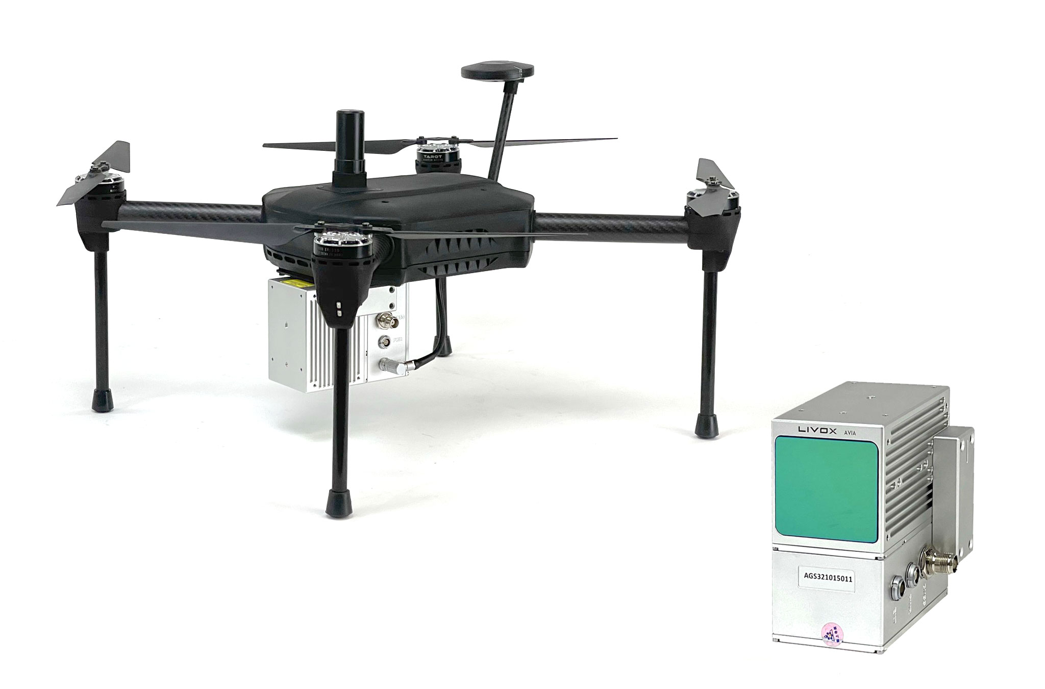
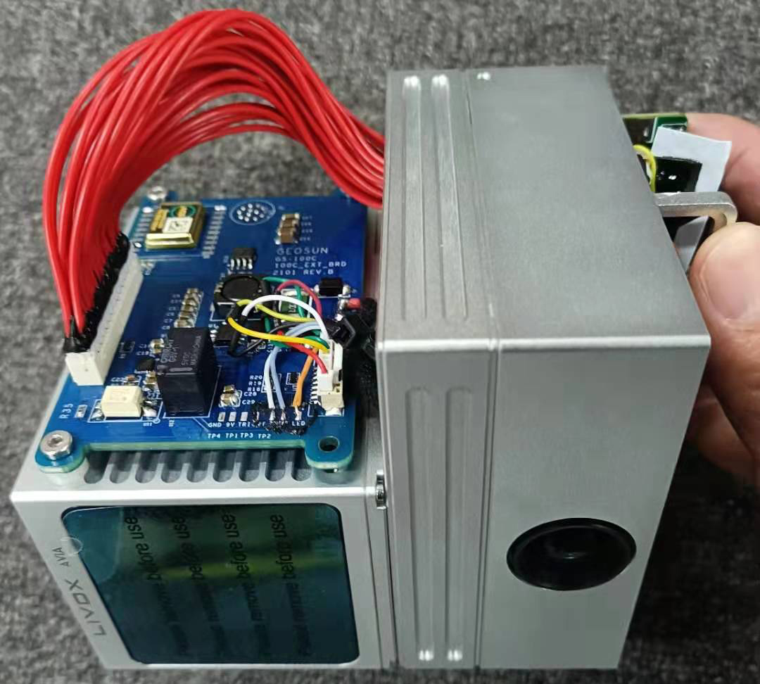
Geosun is integrating ACEINNA’s OpenIMU330BI and IMU383 inertial measurement units (IMUs) into lidar systems that are used to help navigate and guide airborne drone systems, especially those used in a variety of construction planning and mapping operations.
Geosun's products are widely used in land resources, transportation, digital cities, water conservancy, electric power, surveying and mapping, environmental protection, agriculture, forestry, navigation, national defense, and many other fields, and provide complete solutions.
“We are excited to partner with Geosun, China’s leading developer of guidance systems for their lidar scanning systems,” said Dr. Yang Zhao, chairman and CEO of ACEINNA. “We are working with them to integrate our high-performance inertial navigation hardware and algorithms into their various lines of lidar scanning solutions.”
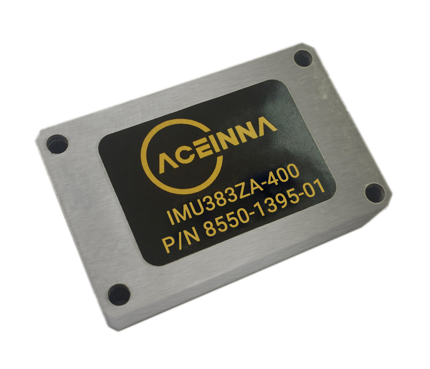
ACEINNA said its OpenIMU330BI and IMU383 can provide accuracy of up to 1.3 degrees/hour. It added that the hardware and software for its triple-redundant IMUs are designed to be easy to integrate and provide cost-effective guidance and navigation.
The company claimed that its products are suitable for a wide range of autonomous vehicles, including mapping drones, delivery robots, and self-driving cars and taxis. They are also useful for advanced driver-assist systems (ADAS) such as electronic stability control and lane-keeping applications, it said.
“The reliable, accurate performance of ACEINNA-brand IMUs has helped our lidar scanning systems to sell very well,” said Dr. Hongxing Sun, CEO of Geosun. “They are extremely popular with our customers. And, in the future, based on our mutual understanding and benefits, we plan on further strengthening our cooperation with ACEINNA.”
Article topics
Email Sign Up

Related Sensors News


Related Companies