Just as cameras using film and cellular phones have evolved into today's digital cameras and smartphones, so too have drones gained utility with lidar and other sensors.
The same pattern of technology improvement lets us get instant output from different cameras and mobile platforms. Aerial imaging and remote inspection were made possible by the development of lidar drones.
But what specifically are lidar drones?
Drones as a breakthrough technology
Also known as unmanned aerial vehicles (UAVs) or uncrewed aerial systems (UASes), drones are small aircraft that can carry various payloads, including cameras. They are typically remote-controlled with devices such as tablets, gamepads, or smartphones.
These flying robots can also fly by using GPS and embedded sensors. Both fixed-wing and quadcopter drones are becoming increasingly autonomous, but in the meantime, the U.S. Federal Aviation Administration offers waivers for operations beyond the visual line of sight (BVLOS).
Drones were initially invented for military use, designed as targets for shooting practice. They became weapon systems later. However, people have realized that drones can be of greater service in civilian and industrial use.
Consumer drones are popular for aerial photography, and licenses are not required for personal use of smaller drones in most states. However, drone videography takes some skill for the best angles and seamless ins and outs, so a professional is highly recommended.
Over the past several years, the drone industry has pivoted to commercial use. UAVs offer value in the fields of agriculture, construction, infrastructure inspection, and delivery service.
Drone innovation with lidar
If you thought you have seen the full potential of aerial drones, you are mistaken. Aside from having built-in cameras, drones have now acquired lidar technology.
Lidar, which is an abbreviation for light detection and ranging, basically uses a laser to gather data and aerial imaging information about surfaces. The collected data can later be translated into 3D models and maps. But how does lidar technology do that?
Licensed aerial surveyors from FlyGuys stated that lidar uses light pulses to scan a subject from a distance. The high-powered lasers are intended to shoot the subject with precise pulses from a distance. It will then measure the pulses that bounce back from the subject to gather information. The whole process is similar to how soundwaves travel for sonar.
At first, lidar-powered devices were attached to airplanes or helicopters to gather data about landscapes and seashores. However, with miniaturization and the rise of drones, the technology reached its potential in the form of lidar drones.
Although airplanes can cover large areas at once, the cost of operating them, not to mention the manpower involved, made it hard for lidar mapping to be comprehensive. However, the lower cost of operating drones has made them attractive for more localized operations.
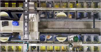
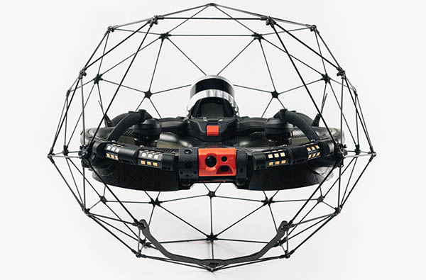
Lidar drones can be more efficient and accurate in terms of gathering data. Since UASes are small, they can move into angles and fit into smaller areas such as caves, providing better mapping data. Flyability's Elios 3 is one example of a mapping drone that can work in indoor environments such as warehouses.
Lidar drones also significantly reduce the risks of injuries since they can be controlled remotely.
How can drones aid inspections?
Remote inspection is the practice of assessing potential hazards or issues in a subject that is impossible to inspect manually due to the subject’s inaccessibility. Thus, this inspection is done at a distance or virtually, using various digital tools.
A remote inspection is often performed when the subject’s environment is tagged as high risk for human workers. To reduce that risk, industries such as energy and utilities now often rely on such inspections. Here are some uses of lidar drones in remote inspection procedures.
1. Safe inspection of infrastructure
Even before the current administration's “Build Back Better” plan, the need to inspect and repair U.S. bridges, power lines, rail, and pipelines was increasingly urgent. Ensuring that critical infrastructure, construction projects, and transportation are reliable can reduce drag on the overall economy.
Field professionals use drone inspections to verify measurements and load capacities of different structures, as well as their current states. In construction, mobile sensors can see if actual structures comply with blueprints and building information modeling (BIM) plans.
For instance, a builder could use lidar drones for remote inspection before doing an on-site inspection to make sure it's safe. Advanced sensor packages can also detect leaks or faulty wiring.
Near Earth Autonomy provides the example of drones for tank farm inspection (see below).
2. Emergency response and disaster recovery
Natural and manmade disasters may not be predictable, but people's lives depend on the ability of first responders to swiftly identify damage and locate people.
In the case of an earthquake or flooding, emergency respondents can determine whether it's safe to enter an area and how to best approach.
After the initial response, government agencies and insurers have also used drones to assess structural damage.
3. Power-line inspections
Manual power-line inspections typically require people to go in lift trucks, climb towers, or take expensive helicopters. The high voltages make line work an especially dangerous profession.
Whether it's for maintenance or repair, lidar drones can not only save time and effort, but they can also get closer to the power lines in question and potentially save lives.
Lidar drone market, applications to grow
The global market for lidar drones could expand from $147 million this year to $508 million by 2027 at a compound annual growth rate of 28.1%, projected Markets and Markets. It noted that uses cases will benefit from the adoption of lidar drones in mining, the emergence of 4D lidar sensors, and demand in the Asia-Pacific market.
The research firm also noted that challenges include purchasing and operational costs, strict regulations in different countries, and vendor consolidation and partnerships. Trade conflict between China and the U.S. has also affected the availability and use of processors and certain drone brands.
There is not doubt that technology has come a long way, and lidar drones continue to improve in capabilities such as range. They can help numerous industries with aerial imaging, and increasing levels of autonomy will enable them to make an even greater difference in any field they penetrate.
About the author
Daniel Martin is a contributing writer. Over the past few years, he has built high-performance teams that have produced content that has engaged millions of users. After working in the aviation industry for nine years, Daniel today applies his international team-building experience in LinkDoctor.
Article topics
Email Sign Up

Related Inspection News