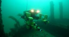
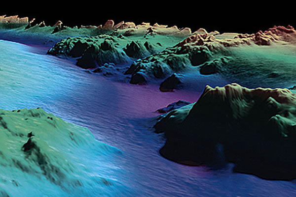
Like outer space, Earth's oceans beckon scientists, prospectors, and roboticists. Terradepth Inc. is building the Terradepth Virtual Ocean on the Ocean Data Cloud technology it launched last year. The Austin, Texas-based startup said its goal is to use undersea drones and Virtual Ocean to create a geospatial experience similar to Google Earth.
This week, Terradepth added executives with experience in the Internet of Things, maritime systems, defense, and engineering to its management team. The company, which was formed in 2018, said its high-resolution undersea maps will enable users to gain environmental and other scientific insights remotely.
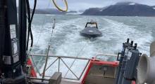
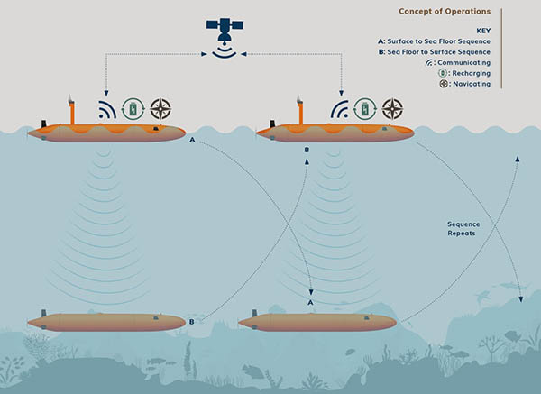
Terradepth said its long-range “buddy” drones shift between collecting data and uploading it to the cloud. They can help overcome existing limitations in unmanned underwater vehicle (UUV) battery life and pressure tolerance, it added.
Judson Kauffman, a former U.S. Navy SEAL and co-founder and co-CEO of Terradepth, answered the following questions about his company's technology from Robotics 24/7:
Drones to the deep
How deep can Terradepth's umanned maritime systems (UMS) or autonomous surface and subsurface vessels (AxVs) go?
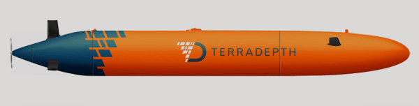
Kauffman: Our prototype is rated to 3,000 meters [9,942.5 ft. or 1.8 mi.], but our commercial variant will be 6,000 meters [19,685 ft. or 3.7 mi.].
Compared with semi-autonomous systems, what's the advantage of more fully autonomous underwater vehicles (AUVs)?
Kauffman: Our systems don't rely on any offshore human support, which significantly reduces risk to humans and operating costs, [since there are] no manned ships.
Are only the “buddy drones” involved with relaying data to the Ocean Data Cloud?
Kauffman: Every system is identical, so at times it will be submerged in collection mode, and at other times,it will be at the surface relaying data.
Pulling data from the sea
How difficult was it to accomplish data fusion from the different sensors involved in undersea exploration? What more needs to be done?
Kauffman: This is been a significant challenge, and there is still a lot of work to do. For example, we have only learned how to integrate or fuse a few types of data, there are dozens of other data types that we're currently working on fusing together.
How much processing occurs at the edge, or is all high-resolution data captured and then sent to the cloud in batches?
Kauffman: This depends on the mission parameters, but basically enough processing is happening at the edge for the drone to know what it saw and how to react. For example, “That was a piece of fuselage, and I need to go back and gather more data.”
The amount of processing done on the edge can be controlled to some extent, and it will change and improve as edge data devices evolve. The robot will choose priority pieces of data, like thumbnail images of processed sonar data, based on what it has been programmed to view as important.
How do you validate data for the Virtual Ocean? Can simulations be run in or on it?
Kauffman: Data veracity is of critical importance to our customers and so it is to us. We have invested considerable resources in ensuring our processes result in very accurate data. We have done this by manually comparing our results with known data sets and making adjustments as necessary.
Our metric is 1 meter of accuracy with respect to geolocation. We also make the metadata available to customers. Yes, simulations can be run on this data.
How often do undersea surveys need to be updated?
Kauffman: The ocean is very dynamic. Any weather event can significantly alter the physical sea floor and water chemistry, resulting in the demand for new surveys.
Certain environmental organizations, like BOEM [the U.S. Bureau of Ocean Energy Management], set requirements for asset inspection frequency, etc. We believe that persistent data collection of the entire ocean is both feasible and important.
Terradepth offers Virtual Ocean access
Your new team members have a mix of government/military, engineering, and business expertise. Is there one area in particular where Terradepth is looking to expand?
Kauffman: This year, our primary focus is offshore wind site surveys and infrastructure inspection.
Will there be different levels of access to the Virtual Ocean? Will customers be able to share survey data?
Kauffman: There will be different levels. For example, we want schools to have access for their students to be able to virtually explore the ocean, and we do not expect this to be a profit center. Those costs will be subsidized by our commercial and government customers, who will have an elevated membership.
[Our system] has been designed to enable collaboration and data sharing—this is indeed an invaluable feature.
About the Author
Follow Robotics 24/7 on Linkedin
Article topics
Email Sign Up
Related Underwater News