Image Courtesy of TOPODRONE
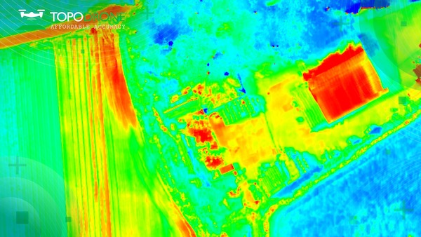
Thermal data captured with TOPODRONE PT61 camera. Image Courtesy of TOPODRONE
Get news, papers, media and research delivered. Sign up for our free newsletters.
Stay up-to-date with news and resources you need to do your job. Research industry trends, compare companies and get weekly market intelligence with Robotics 24/7.

Image Courtesy of TOPODRONE
Thermal data captured with TOPODRONE PT61 camera. Image Courtesy of TOPODRONE
TOPODRONE, a Swiss-based designer and manufacturer of high-precision surveying equipment, has released TOPODRONE PT61, a drone thermal mapping solution that performs detailed surveys and delivers thermal orthomosaic maps obtaining accurate 3D models.
The new photogrammetry solution was initially developed in collaboration with AGROWING upon the request of a large North American enterprise client. Later, the work was modified to support a wider use of drone surveyors. The solution comprises a camera with 61 MP resolution and built-in thermal imager. There are also RGB lenses with different focal lengths, a built-in GNSS module and IMU, as well as an API for integration with any UAV. The combination of the PT61 camera with AGROWING’s multispectral lenses establishes the camera as a dual-purpose RGB/Multispectral solution. Using the PT61 camera with AGROWING’s Quad lens, the camera provides 10 multispectral bands of 12 MP resolution, each along with the IR band.
“This year, we observed an increased demand from surveyors for solutions related to renewable energy, said Iliya Shikov, TOPODRONE’s CTO. “Combining thermal and LiDAR data can provide deeper insights, in particular, in solar plant inspections and dam management.”
Ira Dvir, AGROWING’s CEO, said the company welcomed TOPODRONE’s new thermal mapping solution. “It’s a significant step forward in the race to provide valuable data-driven insights into urban mapping, energy efficiency, and disaster response,” Dvir said.
TOPODRONE Post Processing software has been upgraded to optimize remote sensing efficiencies and to deliver high-precision thermal orthomosaic maps.
Earlier this year, TOPODRONE released TOPODRONE SLAM 100 for mobile mapping and a new lightweight 360° LiDAR model range: TOPODRONE LiDAR 200+, 100 & 100+.
TOPODRONE is a Swiss based designer and manufacturer of high-precision surveying equipment for installation on UAVs, vehicles, and backpacks. TOPODRONE’s hardware (LiDARs, high-resolution cameras and PPK) are used for mapping and 3D modeling.
AGROWING’s vision is to provide the required technologies for real-time Leaf-Level AI trustworthy detection and identification of pests and diseases of agriculture crops.
Want to learn more about data management in robots? This article was featured in the September 2024 Robotics 24/7 Special Focus Issue titled “Robots as mobile data platforms.”
Autonomy Drones News Agriculture AGROWING Drones Thermal Analysis TOPODRONE
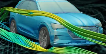
From geometry preparation to AI-assisted analysis, integrated CFD workflows…

North America’s largest robotics and automation event winds down
Automate’s largest day ever draws huge crowds to McCormick Place

North America’s largest robotics and automation event kicks off