Found in Robotics Companies & Businesses, with a score of 12.05
February 25, 2013
PINC provides scalable software, hardware, and services that enable companies to identify, locate, and orchestrate inventory throughout the supply chain predictably and cost-effectively. The company’s cloud-based real-time tracking platform, powered by an Internet of Things (IoT) sensor network that includes passive RFID, GPS, computer vision, cellular, and other sensors, provides actionable insights and connected expert guidance that allow organizations to optimize their supply chain execution. PINC is part of Kaleris, an Accel-KKR Portfolio Company.
Found in Robotics News & Content, with a score of 7.90
August 16, 2021
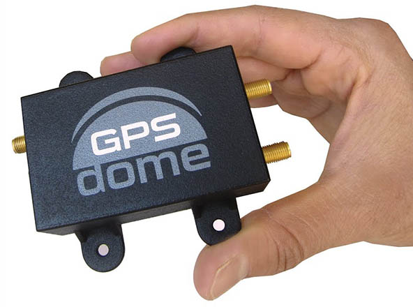
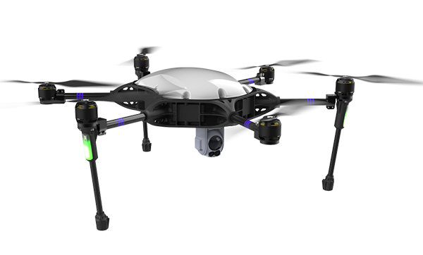
…vehicles. “In combining Honeywell’s best-in-class navigation sensors with leading-edge GPS resilience technology from InfiniDome, we’re working to develop a first-of-its-kind holistic solution built on tightly integrated layers of protection for all uses of navigation for unmanned air and ground vehicles,” said Omer Sharar, CEO of InfiniDome. InfiniDome said it provides front-end cybersecurity to protect wireless communications from jamming attacks. The Caesarea, Israel-based company designs systems to monitor and secure the GPS systems in drones and other unmanned systems, vehicle fleets, and critical networks, as well as defense applications. Autonomous systems must account for GPS unreliability Around the world, GPS signals…
Found in Robotics News & Content, with a score of 5.39
October 28, 2021
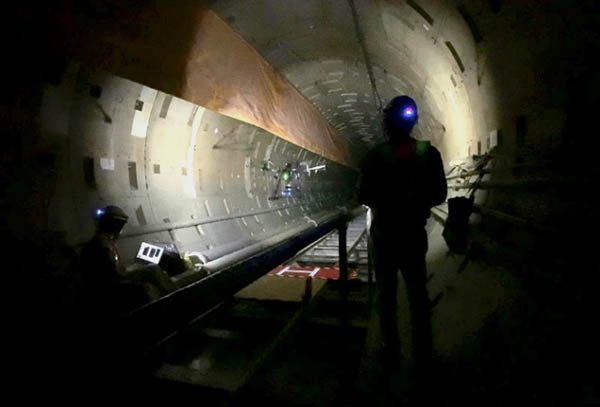
…hazardous. Autonomous drones can help, but they typically require GPS to navigate. Kajima Corp., one of the world's largest construction companies, today said it has partnered with Near Earth Autonomy Inc. to develop targeted systems to inspect such GPS-denied environments. “We are pleased that many of the autonomy capabilities that we developed for aerial transport also have valuable inspection applications,” said Dr. Sanjiv Singh, CEO of Near Earth Autonomy. “Autonomous inspections enable the safe identification and rapid correction of issues. Kajima’s innovative leadership, industry insights, and scale make them ideal partners. We are delighted to collaborate with Kajima to scale…
Found in Robotics News & Content, with a score of 3.77
August 15, 2021
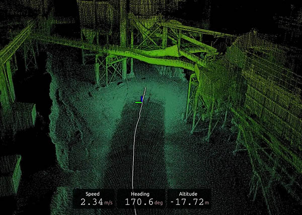
…cases. However, these industrial environments are often devoid of GPS, which can make it impossible for robots that rely on this technology to position themselves in order to navigate. Instead, ultrasonic and localization technologies are emerging for navigation to pin-point damage mechanisms, as well as provide reproducible data. These deliverables can help predict the future safety of the sites being inspected. Challenges inside GPS-denied environments The main reason for sending mobile robots for inspection, maintenance, and repair is to avoid putting employees in dangerous situations. Inspections are necessary for identifying, predicting, and managing problems that could require maintenance to guarantee…
Found in Robotics News & Content, with a score of 3.33
January 21, 2019
…basic download and debug to reference implementations of loosely-coupled GPS/INS. Third is a full Developer Site and tools with charting, graphing and algorithm simulation. “OpenIMU enables advanced, easy-to-deploy localization and navigation algorithm solutions for a fraction of the time and cost of traditional methods. OpenIMU's combination of open-source software and low-cost hardware enables rapid development of advanced solutions for drones, robotics, and autonomous applications,” explains Mike Horton, CTO of ACEINNA. “OpenIMUTM is a first of its kind, professionally supported, open-source GPS/GNSS-aided inertial navigation software stack for low-cost precise navigation applications.” The OpenIMU Development hardware development kit includes JTAG-pod, precision mount…
Found in Robotics News & Content, with a score of 3.32
March 18, 2021
…on high-definition 3D models of indoor parking facilities, where GPS signals are typically restricted. Indoor parking facilities currently present many challenges for drivers. These include navigation system blackouts, finding a vehicle within large parking facilities, and locating vital services such as electric vehicle charging stations. London-based Parkopedia said its indoor mapping technology can be used in the following use cases: In-vehicle indoor navigation—no GPS dead zones Precise indoor positioning—locate your vehicle Automated valet parking—self-parking cars require indoor maps As the automotive industry embraces a connected future, indoor mapping technology will deliver further key benefits to users, claimed the company. For…
Found in Robotics News & Content, with a score of 2.25
December 07, 2021
…Inc. yesterday announced the Robust Navigation System, which integrates GPS anti-jamming technology, a radar velocity system, and an inertial navigation system. The companies claimed that the technology is the first resilient system allowing drones to not only safely operate, but also successfully complete their missions, even in GPS-challenged or fully denied environments. Unmanned aerial vehicles (UAVs), from a 20-lb. Class 1 multicopter to a 150-lb. Class 3 fixed-wing drone, rely almost entirely on the Global Navigation Satellite System (GNSS) for the most basic navigation functionality, particularly for beyond visual line-of-sight (BVLOS) and autonomous operations. Due to the weak and vulnerable…
Found in Robotics News & Content, with a score of 1.86
July 30, 2021
…after arriving on site, said Cansel. Robot includes onboard GPS In addition, TinySurveyor uses an an onboard Trimble GNSS (Global Navigation Satellite System) receiver. “This GPS receiver is a rugged, all-in-one solution combining strength and durability into a compact form that is easy to use and virtually indestructible,” said Cansel. “Its rugged construction and longer battery life make it ideal for more demanding field work and reduce the risk of downtime. The Trimble receiver is both user-friendly and highly accurate.” With the tablet and Trimble GNSS receiver, TinySurveyor can execute large tasks up to 10 times faster than traditional surveying…
Found in Robotics News & Content, with a score of 1.57
November 10, 2022
…handles the complexities of self-navigation without needing a map, GPS, or wireless infrastructure. The result is a detailed and accurate map collected with minimal human intervention and risk, the companies claimed. “The integration of autonomous surveying technology into a construction workflow has groundbreaking potential,” said Aviad Almagor, vice president of technology innovation at Trimble. “It can improve operational efficiency and transparency throughout the build lifecycle while also transforming worker safety for potentially hazardous data collection.” “Industry has been waiting for reliable and robust autonomous technology to transform difficult and dangerous activities. Exyn's technology is helping to enable a new front…
Found in Robotics News & Content, with a score of 1.52
October 18, 2022
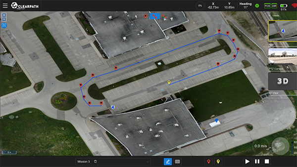
…launched OutdoorNav, a software platform that it said provides GPS-based navigation for faster, more efficient autonomous vehicle development. The company said OutdoorNav is compatible with its outdoor mobile robots and third-party industrial vehicles. “Robotics product development can often be a difficult, sometimes harrowing experience,” stated Bryan Webb, president of Clearpath Robotics. “Building a robust navigation system is expensive and risky, and it may prevent you from bringing your product to market in a timely fashion.” “We built and designed OutdoorNav to streamline your development of autonomous vehicles,” he added. “You no longer need a full team of robotics navigation experts…
Found in Robotics News & Content, with a score of 1.49
December 09, 2022
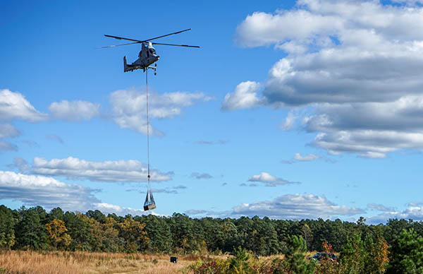
…take off, fly, and land safely, with or without GPS. It has designed systems to enable aerial mobility applications for partners in the commercial and defense sectors. The Pittsburgh-based company claimed that it bridges the gap between aerospace and robotics with complete systems that can improve efficiency, performance, and safety for aircraft ranging from small drones to full-size helicopters. Pittsburgh Technology Council honors local leaders The Pittsburgh Technology Council recognized Near Earth as an innovator of the year. Source: Near Earth Autonomy The Pittsburgh Technology Council said it celebrates the most successful and innovative technology companies in Southwestern Pennsylvania at…
Found in Robotics News & Content, with a score of 1.47
December 20, 2021
…use artificial intelligence for robots and drones in complex, GPS-denied environments, companies need to partner to share expertise. Identifying reliable technologies and partners can be a challenge. Exyn Technologies today announced that it has received ISO 9001 certification. The Philadelphia-based company said the globally recognized certification distinguishes businesses with management systems that have been thoroughly tested and audited to meet defined standards in areas such as safety, quality, and sustainability. “ISO 9001 is the internationally recognized standard for quality management systems (QMS),” according to NQA. “It is the most widely used QMS standard in the world, with over 1.1 million…